
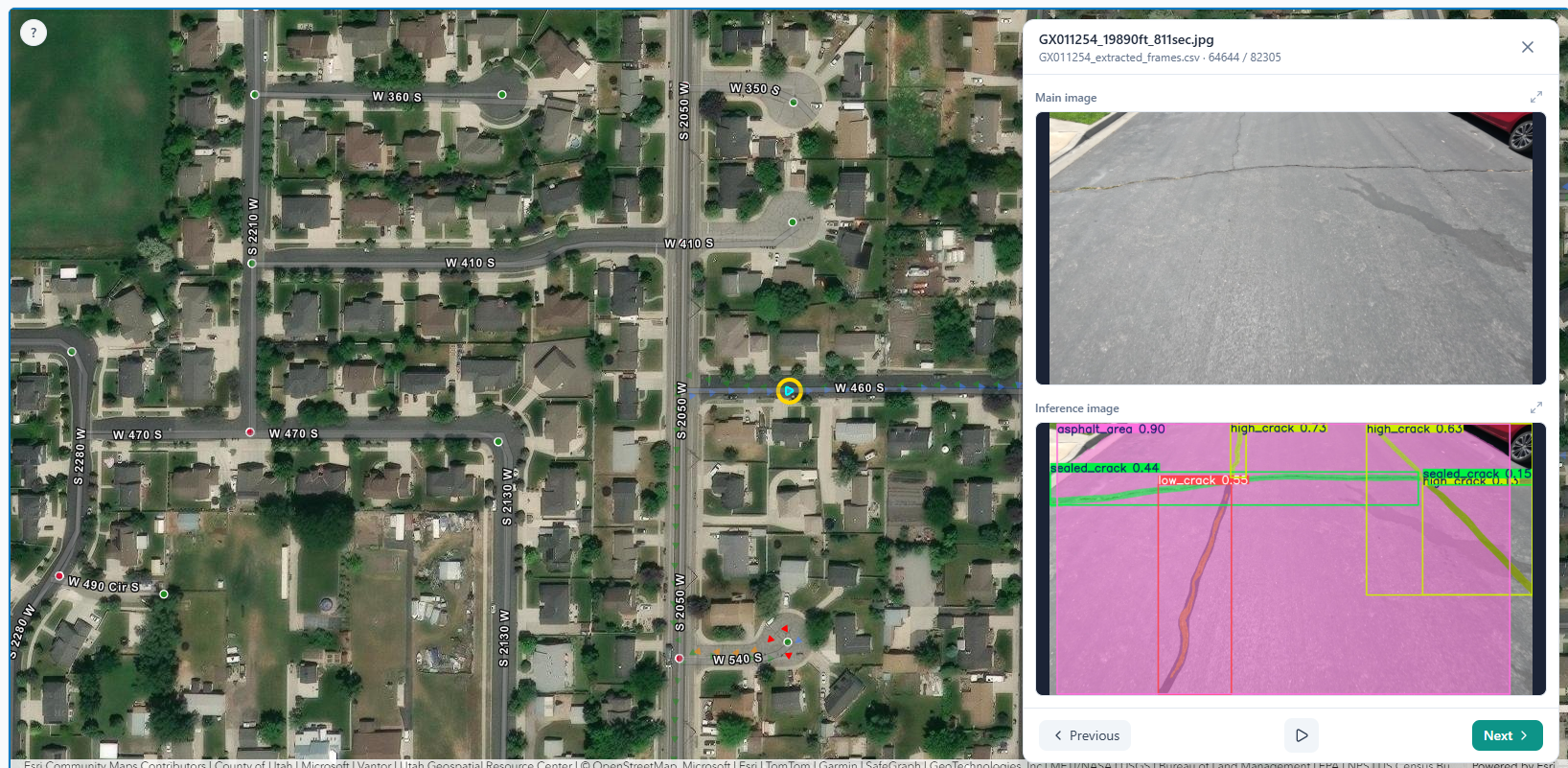
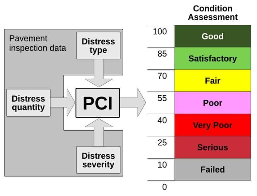
Our AI-powered technology captures road surface distresses and rates every segment with a Pavement Condition Index (PCI) from 0 to 100 — aligned to ASTM D6433 — so municipalities know exactly how each road is performing and where to invest.
Without consistent, defensible condition data, pavement budgets become political guesswork. PCI gives every road a score municipalities can trust — the same way inspectors and engineers evaluate distresses nationwide — so CIP plans reflect reality, not assumptions.


AI analyzes image sensors from our collection vehicles and LiDAR. Then distresses are captured and quantified.

Detected distress types and severities are converted into PCI — a 0–100 score where 100 means brand-new pavement and 0 means failed.

Every dataset passes through SAMS Studio where our team quality-checks and verifies captures before scores are delivered to the agency.

GIS-ready PCI layers feed multi-year maintenance and rehabilitation plans — each road ranked, each dollar justified.
Pavement distresses — cracking, rutting, patching, and more — are identified automatically from the our sensors. Each distress is evaluated against the ASTM D6433 protocol to produce segment-level PCI scores your engineering and public works teams can audit and defend.
Standard pavement distress types catalogued under ASTM D6433 — the same distress library used in PCI references across the industry.
Interconnected fatigue cracks in the wheel path
Cracks form on the surface induced by aging and traffic
Permanent deformation and surface dips
Previous repairs and trench restoration quality
Localized failures and shoulder deterioration
Raveling, bleeding, weathering, and more
Raw captures are only the start. SAMS Studio is our QC workspace where analysts review AI detections, correct edge cases, and sign off on PCI results — so the data your planners import is accurate, complete, and ready for CIP modeling in SAMS or your existing systems.
✓ Geolocated asset inventory (type, ID, attributes)
✓ Condition scores per asset class
✓ Maintenance & replacement year recommendations
✓ GIS layers importable to SAMS / ArcGIS
✓ AI-detected assets with human QC sign-off
Municipal pavement condition inventory
Multi-year pavement strategy
Capital program data & insights
Tell us about your road miles — we'll scope a PCI survey and show how SAMS turns scores into a defensible CIP.